Mt. Diablo Hike
Widget powered by EveryTrail: GPS GeotaggingThe Grand Loop is formed by stitching together several trails and fire roads in a following order: Summit Trail, Juniper Trail, Deer Flat Road, Meridian Ridge Fire Road, Prospectors Gap Fire Road and North Peak Trail. This is how we hiked it, but I would actually recommend doing it in the opposite direction and starting with first going up on the North Peak Trail.
I would strongly recommend this hike to anybody. It is very pleasant (especially on a sunny weekday) and offers spectacular views of - and from - Mt Diablo in every direction. In fact we liked this hike and Mt Diablo so much that we decided that next time we would go there we would spend a night at the campground that we could enjoy views from the peak during the nighttime.
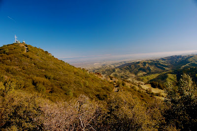
Mt Diablo offers stunning views in all directions:


Mt Diablo peak (on the left) and snow-capped Sierra's on the horizon:

Industrial East Bay:

Happy Monika at the end of the hike:

Are those cones so big or is Anil's head so small?

Golden Gate Bridge at sunset:

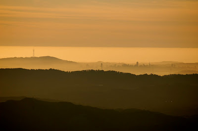
Downtown SF, Bay Bridge and Part of Golden Gate Bridge:

Downtown SF:
