On one of the Saturdays in August we woke up to yet another foggy day in San Francisco. So we (read: I, wifee) decided that our best chance of catching a bit of sun is to go hiking to the highest mountain in the area - Mount St Helena, which at 4'304 feet, is the Bay Area's highest publicly accessible peak.
As we were driving towards the trailhead, we (read: the husband) started loosing hope as it did not look like we would ever manage to get out of the clouds. But, to our great joy, as soon as we reached the parking lot near the trailhead, we started catching the first glimpses of the sun.
We did not see too much of the sun during the first part of the hike, as it initially leads through a pretty dense forest. Only after around 1 mile the trail emerges onto a dirt fire road, and this is when we started enjoying a beautiful sunny day. Actually, the sun was so strong there, that I got a very nice suntan on my arms. So nice, that most of my coworkers thought that I must have been in some warmer place for several days :)
But the sun was not the only attraction of the hike. The other one, equally wonderful one, was being above the clouds! As you can see from the photos below, all the valleys surrounding Mt St Helena were covered by them, which made our hike even more spectacular. When we got to the highest (out of five) peaks of the mountain (the Northern Peak), I overheard several people discussing how unique it is to have so many low clouds covering Napa and Sonoma. They were saying that they had hiked Mt St Helena multiple times, but they had never seen anything quite like this.
By the time we started hiking down the mountain, some of the clouds started dispersing a bit, so we could also appreciate the views of the villages located at the footsteps of the mountain. They looked very picturesque too, so I thought that it would be nice to repeat this hike one day when there is not that much fog covering the whole Bay Area. But I think we will wait with this action item till next year.
All in all the hike was 11.2 miles long, during which it climbed and then declined 2040 feet. The roundtrip took us 4h 20 min, including two longer breaks for water and snacks. We were pretty tired and soar afterwards...
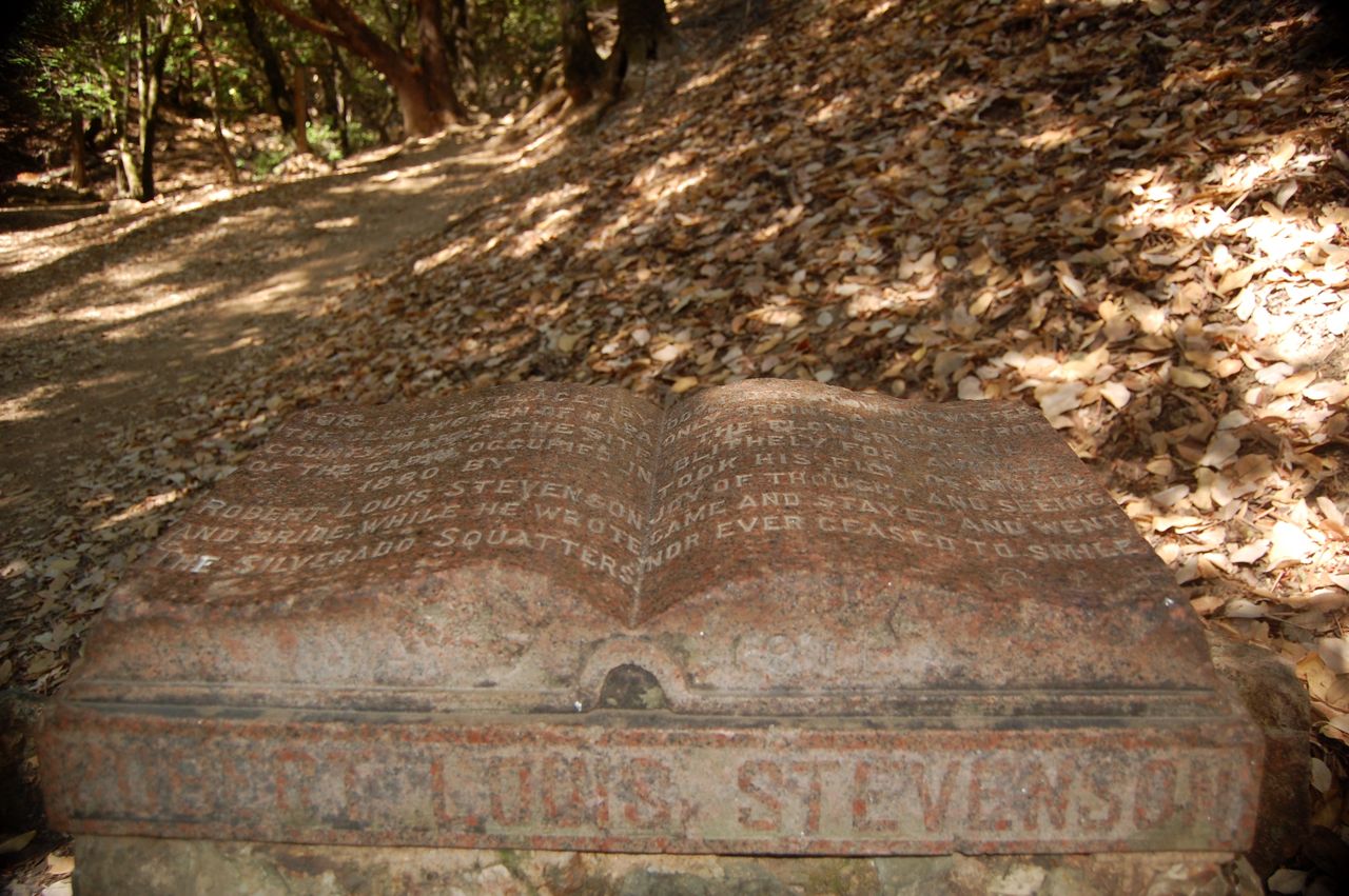
The trailhead of the hike is located in Robert Louis Stevenson Park, and 0.7 mile into the hike one encounters the Stevenson Memorial (Stevenson and his wife spent their honeymoon here):
Hiking above the clouds:


Views from the Northern Peak of Mt St Helena:

On the way back we could see more, as the clouds were slowly retracting:

Windy trail up Mt St Helena:

This photo is a proof that I still love and care about my husband. I had my camera ready in my hands when my dearest husband slipped and fell down on his lovely ass. If I were a true cold-hearted photographer I would have taken a great shot of his fall. Instead, I dropped my camera and checked if he was okay... Love makes people do crazy things.
